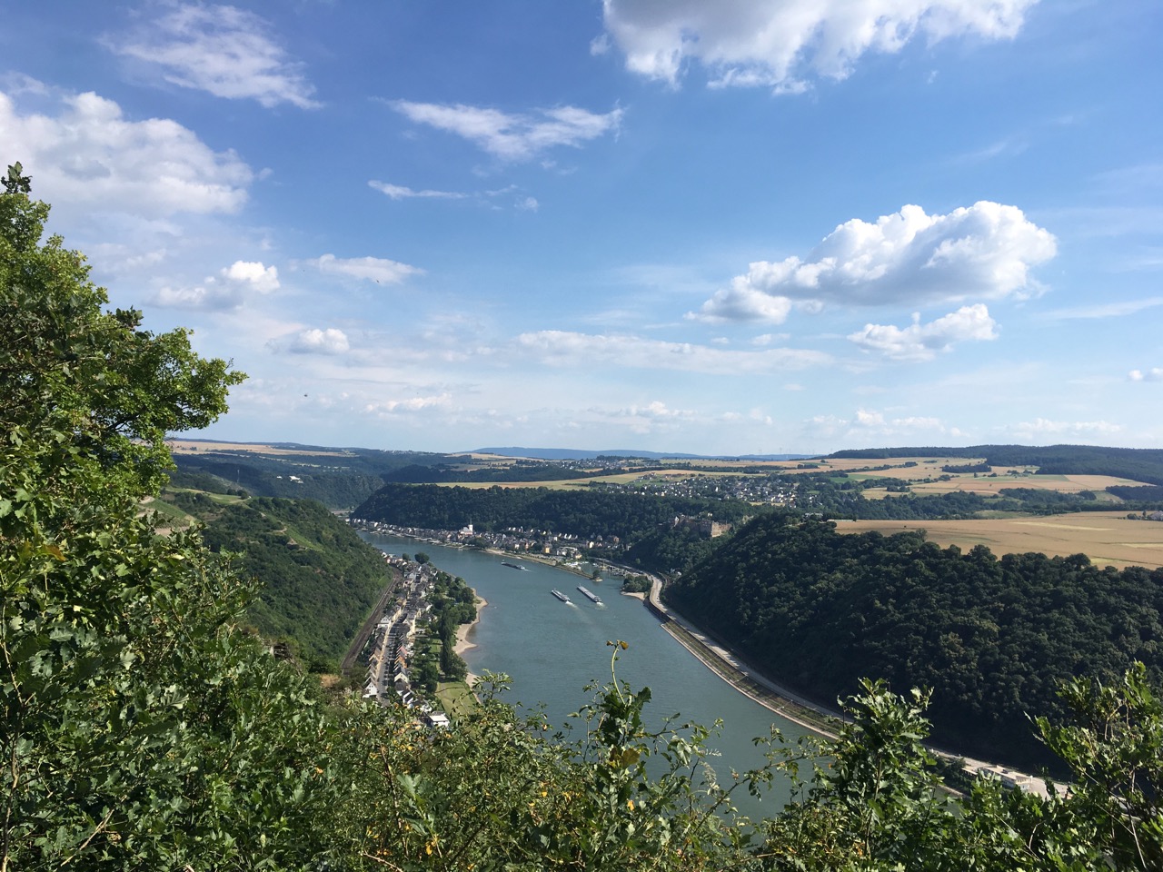
The Rheinsteig is a long-distance walking route that follows the east side of the river Rhine from Bonn to Wiesbaden, about 320km in all. As the “-steig” bit of the name implies, it doesn’t content itself with dawdling along the river-bank (where there are already busy roads, railways and bike-paths), but climbs up into the surrounding hills, often following steep and adventurous paths, and providing spectacular views over the river valley.
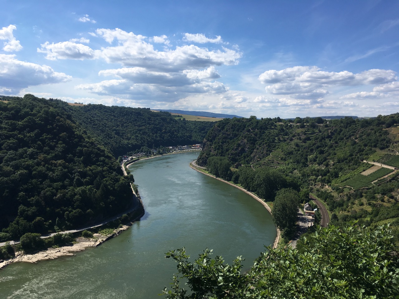
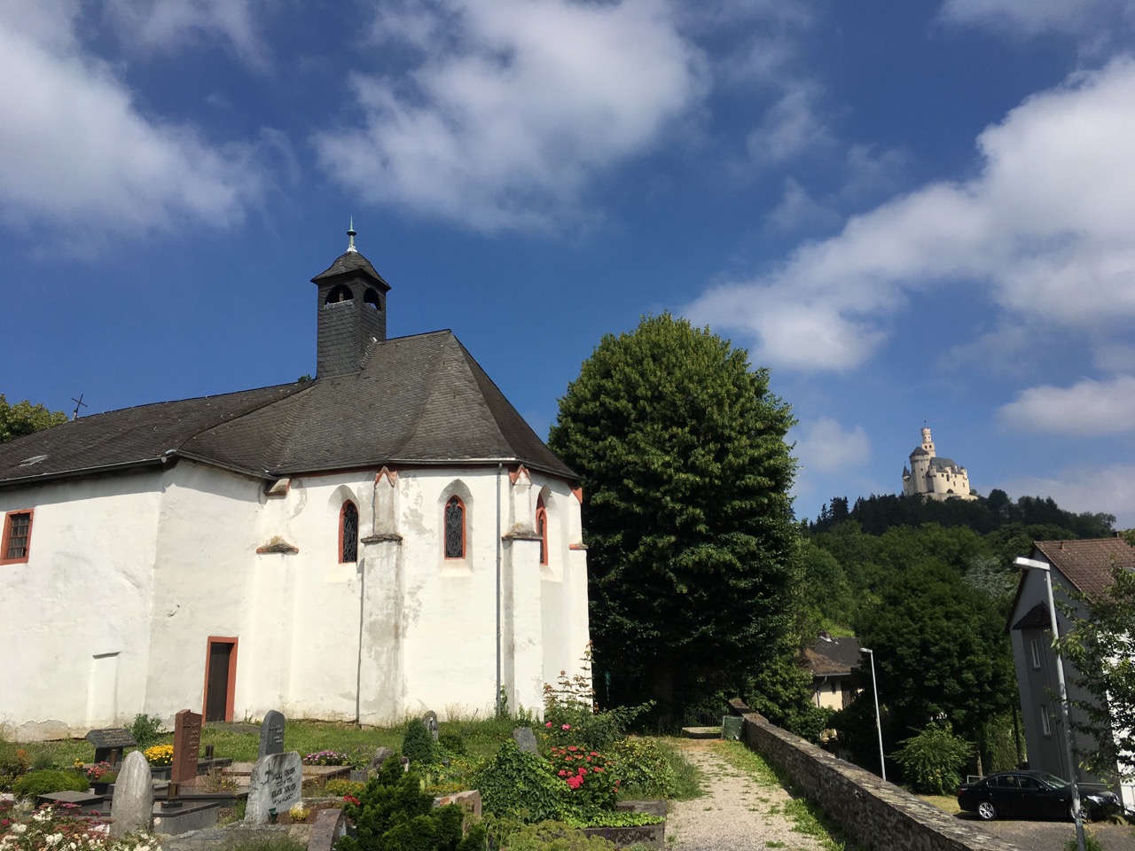
We walked the most famous section of the route, through the Oberes-Mittelrheintal world heritage site, between Braubach and Lorch (76km), over four days. Tough walking, by my standards, but very rewarding. We stayed in St Goarshausen and used trains (and the ship, one day) to get to and from the walks. We also spent one day visiting a couple of castles (Marksburg and Rheinfels) and doing a circular walk around St Goar on the other (west) side of the river to get views across to the Loreley.
Official Rheinsteig site: www.rheinsteig.de
The route is well-marked, with the main route indicated by Rheinsteig symbols in blue, and feeder routes to villages and places of interest off the main route indicated by yellow markers. Where there is a suggested bad-weather alternative to one of the more challenging sections, there are signs to indicate this as well. Something to watch out for when you're planning a tour is that the "stage-points" in the official listing are on the main route, which doesn't always go down into the towns you'll actually be starting from, and sometimes (e.g. at Kamp-Bornhofen) does a lengthy loop around above them, with multiple points where you can join or leave the route. The distance and amount of ascent you actually do walking from one town to another could be quite different from what you see on the website or in guidebooks.
As is typical in Germany, there is a generous provision of benches, picnic tables, shelters, information displays and the like along the route, and the viewpoints are usually kept clear of obstructing vegetation. All the Rhine valley towns have railway stations, with local services at least once an hour, and most can also be reached using the scheduled passenger ships of the KD line (and various competitors) during the summer months.
There are interesting walks on the other side of the river as well, of course, but it’s tricky to combine walks on both sides, as there are no bridges between Koblenz and Rüdesheim and ferries are quite widely spaced. “Up one bank and down the other” is really only feasible for cyclists.